

It’s no coincidence that there’s a huge running community in Spokane. We have endless trails and scenery galore! If you’ve been looking to switch up your run, here’s a list of tried and true routes around town.
Kendall Yards Gonzaga Loop

START & END – Fleet Feet Running Store
MILES – 3.7
DIFFICULTY – Easy
NAVIGABILITY – Moderate
NOTES – If you’re looking for flat, this is your route! The route takes you on the Centennial and since the Post Street Bridge is under construction, you go by Anthony’s (great restaurant) and then up a hill and past Clinkerdagger’s in The Flour Mill (another great restaurant) to a building with a big beautiful butterfly on the wall. From there you pass a giant park and then continue around the river. The final part of the route leads you across the Monroe Street Bridge and you can take some steps down on your right back to the trail or just take a left on Summit Parkway back to Fleet Feet!
SEE THE ROUTE – https://onthegomap.com/s/9ancd61b
Finch Arboretum Loop
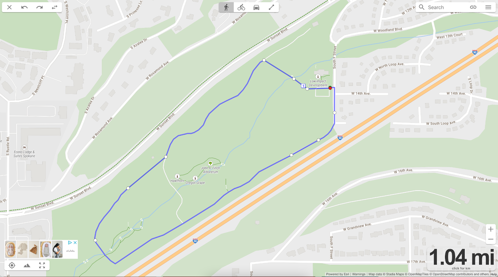
START & END – Finch Arboretum
MILES -1+ miles
DIFFICULTY – Easy
NAVIGABILITY – Moderate
NOTES – Just stay on the trail and enjoy Finch Arboretum! If you want to add on more, go to the intersection of Woodland Boulevard and ‘F’ Street, and run on “The Street Tree Exhibit”. It is a street lined with different trees! You then will take a right when you hit the T and cross the bridge over 90. Follow the road and that will take you to Fish Lake Trail (take a right) where you can run as far as you want as an out and back.
SEE THE ROUTE – https://onthegomap.com/s/lv3am2d1

River Trail Doomsday Loop

START & END – People’s Park
MILES – 6.35
DIFFICULTY – Difficult
NAVIGABILITY – Difficult
NOTES – Start and end at People’s Park. In some ways this route is similar to the famous Bloomsday course except instead of running on the roads you are running on a trail for half of it along the river! It is a single track trail so make sure to watch your footing! Doomsday hill provides a great challenge, but once you make it to the top you are in for a treat in terms of flat or downhill!
SEE THE ROUTE – https://onthegomap.com/s/qa7r6u2s
Fish Lake Trail Out and Back

START & END – Fish Lake Trailhead
MILES – 1 to 18
DIFFICULTY – Easy
NAVIGABILITY – Easy
NOTES – This asphalt trail could take you all the way into Cheney (although there is a small part of the trail that isn’t connected), but most people just do an out and back on it their desired distance.
SEE THE ROUTE – https://onthegomap.com/s/e89c5k30
Trolly Trail

START & END – S Assembly Road (there is a parking lot)
MILES – 3.4
DIFFICULTY – Easy
NAVIGABILITY – Easy
NOTES – If you love trails, this is a fun, hidden gem in Spokane! Park in the parking lot off Assemble and do an out and back on Trolly Trail! The flowers are beautiful this time of year!
SEE THE ROUTE – https://onthegomap.com/s/m9cttcee
Vinegar Flats Brownes Addition Loop

START & END – Hello Sugar
MILES – 5.7
DIFFICULTY – Moderate
NAVIGABILITY – Difficult
NOTES – This one is a little more specific/ trickier to navigate so use your discretion.The hardest part of this run is in the first 2 miles. From Hello Sugar down to the river it is a steep downhill. You then get some flat as you navigate your way to Vinegar Flats following Latah Creek. Once you cross the bridge (over Latah Creek) and take a left on Inland you have a steep uphill (100 feet of elevation gain in a quarter mile). The most difficult part (in terms of navigation) is making sure you don’t miss the VERY STEEP short trail on your left that gets you up to Sunset Blvd. so you can go through Brownes Addition. This would be a good route to take your phone on (for safety reasons and to track the route).
SEE THE ROUTE – https://onthegomap.com/s/vqscst5g
Want to stay up to date with Spokane running? Follow husband and wife, Sam and Bekah Read at ReadsRun on Instagram! Sam is a college cross country and track coach and realtor with The Fowler Group and Bekah is a stay at home mom while running (no pun intended) her website design business, Rebekah Read Creative


 Hi! I'm Chandler, owner of Spokane Eats, and I think life is too short for the mediocre. Our team is here to help you discover why we fell (and continue to fall) in love with Spokane Washington!

0 Comments